Posted by: natsevs | January 4, 2011

The Ice Cream Diaries


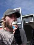
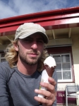
Mint Cornetto 27th March                                  Honeycomb 28th March  

Poppit 6/10                                                     Aberaeron  10/10


Nobbly Bobbly 7th April, Trearddur       Anglesey Chocolate 99  9th April Moelfre

9/10                                                                             8/10


Magnum double caramel 12th April         Cinder Toffee 14th April

Llandudno 6/10             Nicholls famous Ice Cream, Parkgate  10/10


Chocolate lime 17th April                      Fudgie 18th April

Tootsies, Little Hoole 8/10                       Blackpool 3/10


Toffee Fudge 21st April                    Cappuccino 22nd April

Coffee Pot, Grange-over-sands  8/10                  Baycliff 7/10


Cookies 26th April          Dumfries and Galloway Caramel Shortbread 9th May

Twentyman’s Allonby 9/10                        Mull of Galloway 8/10


Baked Apple crumble 14th May                         Kitkat Cornetto 26th May

Mancinis, Prestwick 10/10                                                   Inverary 4/10


Cornetto Classico 1st June                                Blue Banana 9th June

Tayinloan 6/10                                                     Pokey Hat, Oban 8/10


Crunchie 22nd June                              Mint Feast 27th June

Mallaig 7/10                                                     Kyleakin 6/10


Peaches and Cream 20th July                                      Mars 23rd July

Sweets, Gairloch 8/10                                                Durnamuck 5/10


Malted Magic 25th July                               Irn Bru 9th August

Ullapool   8/10              Pokey Hat Van, Dunbeath 8/10


Apple 24th August                   Strawberry 10th September

Anstruthers 7/10                                                          Cramond 7/10


Sea Buckthorn 11th September         Strawberry Top 20th September

Gullane  8/10                                               Pacito’s, Redcar 6/10  


Whitby Gothic 21st September              Orange Swirl 30th September

Whitby    9/10                                                        Seathorne  5/10


Vanilla Fudge Brownie 6th October     Coconut Chocolate Ripple 11th October

Cromer   9/10                                                            Felixstowe 6/10


Tiramisu 24th October

Herne Bay

6/10

Posted by: natsevs | January 3, 2011

Bosham to South Parade Pier: THE END

In the morning I sorted my bag out then headed downstairs to have some breakfast. Jess was leaving for work at 8.30am so I set off at the same time but took an immediate detour to the shop before starting properly. Once stocked up for the day I got onto the road once again before going out onto the path on the waters edge. The coast took me down to Chidham and around the peninsular there to start coming inwards again. As I got up towards the head of the bay there started to be a few people milling around, either fishing or dog walking as it wasn’t too bad a day weather-wise. I was on the familiar ground of levees along here to Southbourne where there were loads of old people sitting on benches having their sandwiches and chatting away. My path became the Sussex border path here and took me down towards Thorney Island. The path was still a good one until ‘The Great Deep’ where I was met by a heavy duty military fence and locked gate. Having lived not very far away from there for 23 years I was surprised I didn’t know it was a military zone. I stood there for a little while before I saw the sign beside the gate saying to press the buzzer and talk to them to get in, it also informed me I would be watched by CCTV the whole way round. I pressed the buzzer and told the guy I would like to walk the footpath then had to say my name 4 times before he heard it properly and buzzed me in.

I have no idea what all the security was about because it didn’t look like there was anything significant there and the cameras must have been very high tech because I couldn’t even see them. The path carried on as before, along the front, with the airfield to my right to start with and then the sailing club and a church. I started needing to relieve my bladder but was worried about the whole ‘we are watching you’ thing and wasn’t sure if it is an offence to wee on military ground. I hung on and continued to the end where there was more countryside and a bird hide for looking out on the marshes. A little further on from there I stopped to have my pasta pot lunch then got to the gate on the other side. At the gate I buzzed and asked to be let back out again. Now out of the military area I carried on up to the marina at Emsworth where a path going straight on took me to a drop into the sea so it turned around and went in through the boatyard. To get past all the water I had to come right in to the main road then tried to get back out to the shore along little roads following cycle path signs. By following these I got out to the Mill Pond then round the front to join the familiar path along the beaches to Langstone and the Royal Oak pub. I used to work at the Royal Oak a few years ago and have walked dogs along their many times. I stopped at the Oak and wrote a blog as I had a drink and caught up with a few people I knew who were still working there. I was due to stay with Andy Moon who had come to walk with me back in Stranraer and he arrived just after 5. We had a pint there then 2 of my other mates, Gav and Gareth rang to say they would head over too so it turned into a few drinks in the pub before Moon drove me back to his house on Hayling Island.


I woke up quite early and ate all of my harvest bars as I packed my bag away before jumping in the shower. The Moon’s were up when I got out so I had my breakfast before I was dropped back off at the Oak to continue onwards. The plan was to just walk around Hayling Island in a day then the following day I would walk from the bridge to the finish line at South Parade Pier. This meant these last few days were fairly short ones. I’d stopped the afternoon before at 3.30 and getting round Hayling would be around 18miles. I had been slowing down for about a week already, not because I didn’t want to finish but because I had named Friday 5th November as my finish date and people like my uncle and brother had taken the time off work to come and see me at the end. The temptation was definitely there to walk the usual distances and sneak in a day or 2 early to avoid a scene but I resisted mainly because 300days is a nice round number. Despite the fact that I was staying at Andy’s again, I wore my full pack for the days walk because it was the penultimate opportunity to do so. I had left the tent though.

I walked the front to the bridge and over onto Hayling following the road immediately left to Langstone Hotel and round towards Northney. Shortly I came to a car park with a footpath going out of it towards the shore so I got onto that and took it along for a while before hitting the dead end of a heavily barbed wired fence. I attempted to get over it but quickly realised I wouldn’t be able to without at least halving the possibility of having kids. There were worn footpaths going off in several directions and all led to more dead ends so I ended up wasting a lot of time. The most annoying thing was that the housing estate to my right had a couple of gates leading into it but all were padlocked shut. In the end I had to go right back to the car park and stick to the road from there on. I kept to the roads nearest the coast until I came to a point where a new footpath went right along the edge and this one was actually marked on the map so I had hope. It took me along to and through a caravan site then round Verner Common to a yacht building yard where I had to rejoin the road. There was soon another footpath though which went along the golf course from Tournebury to Mengham and another road. This one took me out to the sailing club there where I joined another footpath that stuck to the coast all the way to Eastoke and the creek there. I rounded the creek on a road which gradually became less well maintained and the houses turned to caravans. I went along somebody’s driveway to get across to the next road but then was blocked off again with no option of a swift trespass to get past the obstruction.

The detour was a trip right in then out again to join the sea front path around Sandy Beach. Once around the corner the wind hit and made life very difficult and knackering all along the south side of the island. It was a pain for me and I even hid behind a beach hut to have lunch but it meant the sea was full of kite surfers making the most of it. Some of them were getting insanely high with their jumps although when I was walking along the fence of the golf course further on there were a few on the beach and one guy lost hold of his kite which then flew up the beach. He chased after it until it hit the fence, was pinned there for a second then flipped over and onto the course where it landed. The guy went back to collect his stuff then started off round to the golf course to because none of the golfers made any move to help, they just kept on playing around it. Walking along at that end I got my first view of South Parade Pier since leaving it 299 days before. At the end of the golf course and the south side of the island I came round the corner to the ferry. Once there I was back to roads again briefly past some pretty big houses before getting onto the Billy Trail all the way up the west side of the island. The trees either side sheltered me slightly from the wind finally. Back up the top there are a load of pools that it looks like you used to be able to walk around but that definitely wasn’t the case any longer. The path took me back to the main road and the bridge back to the mainland. I stopped at the Ship Inn this time and got a drink whilst I waited to be picked up, coming out at 5.15 because it was a bit noisy I was due to have a radio interview in 5 minutes. Thanks to the wind it wasn’t much quieter outside but Moon turned up and we headed back to the house. Radio Solent rang whilst we were in the car but the place we stopped at is apparently the mobile black spot of Hayling so it was a short and painful interview.


I had a decent sleep but there was no rush to get up and going because I had worked out there was only about 13 miles to do and I had settled for 4.30pm as a finish time. Andy’s dad had made porridge for breakfast so I tucked into that then got ready nice and slowly. This is the day I had been dreading. I knew I would miss the adventure of the walk but was ready for a relax, the thing I was dreading was walking in to a crowd of people. To give you an idea of how uncomfortable I am with these situations; I quit beavers when I was little because I had been given beaver of the week the week before and was petrified of having the others look at me when I walked in. So petrified that I hung on to a lamp post as my mum pulled at my feet to try and make me go. Moon was walking with me and turned out to be welcome company to keep my mind off the impending.

We were dropped off at the Ship and set off along the cycle path over the road which took us to the Langstone harbour path going right along the shoreline on little sea defences. I had never known there was a footpath there and my very old map didn’t show it so it was a pleasant surprise to find myself on it. We went along there until we hit a creek with a tarmac plant sticking out into it. The big crane-like machine there looked like it was close to collapse but thankfully we wouldn’t be getting very close to it. We had to come in and round to the road where we crossed part of the creek on a bridge before dropping down below it onto another shoreline path. This path led to Farlington marshes, took us round them and onwards towards Portsmouth. The path before the bridge was blocked off but we rounded the fence because there was no obvious reason as to why and we didn’t fancy some motorway-side walking. We got along fine and reached the roundabout and bridge to Eastern Road. There was only road walking for a brief period before we found another path we weren’t aware of that stretched right along the front past the outdoor centre and other places.

My Uncle Paul and Sue had rung to say they were parked near the Harvester so when we got there we stopped for a hot chocolate and a bit of time wasting as despite the late start we were still on track to finish quite early. I didn’t enjoy the talk of the finish and things weren’t improved when my older sister rang to say she was making a banner with my nieces to wave at the finish on mum’s orders. I didn’t hide my thoughts on this and afterwards got onto my brother to make sure things were as low key as possible. A little further down we stopped for lunch at a picnic table in the miserable misty rain. Another chunk of time wasted we continued down to Fort Cumberland and walked right up to the ferry point despite having to then turn around and walk back on exactly the same road until we were able to take a left out to the esplanade at Eastney. There were 1 or 2 kite surfers there but nothing compared to the previous day. It was no time until the pier came into view and wee were still too early so turned in at the pitch and putt to find a pub. We stopped at the Eastney Tavern and had a pint each. At 4.15pm we went back to the esplanade then stopped a little way from the pier to wait for another radio Solent interview in a slightly sheltered spot. When we walked on, an old primary school teacher of mine drove up and stopped to say well done after hearing the radio interview. Then a bit further down Moon left for me to finish alone and soon the wall of people was visible. It was more a small group than a crowd but spread out they looked terrifying.

 When I was near enough for them to cheer I wanted would have loved to have turned and run. It wasn’t the people I knew that worried me, if it had just been them it would have been fine but we were in a public place and I’m generally quite good at falling into the background. Now though strangers were looking at me wondering who the hell I was. So I walked in and finished and everyone stood off me expecting a speech, my dad said he’d do one which I told him he would not but thankfully it was short, then Jon, my brother rescued me and it was ok from there because I could just talk to people. After a bit we all headed back to Eastney Tavern and had some celebratory drinks before I headed home to have a curry, make use of my own bed and look forward to a lie-in followed by doing absolutely nothing. After 300 days and around 6500 miles i was done. For now.

Posted by: natsevs | December 21, 2010

Shoreham to Bosham

I had a really good sleep but had no idea what time it was when I woke up thanks to the clock change. One phone clock had gone back whilst the other one hadn’t so I was able to work it out and realise that yes, it was time to get up. I got packed up, went downstairs to watch TV and waited for Katie and Giles to get up. Giles cooked a fry up which was pretty good then I was dropped back off at the station to get trains out to Shoreham to start the day. I just missed one train as I was trying to work out which platform to go to then had to wait another 20 minutes for the next one, not arriving in Shoreham until 10.50. Not ideal. I went back over the pedestrian bridge to Shoreham beach and made my way straight over to the front to start off. I had to walk the roads at first but then I was able to get onto a sea front path to Worthing. When I got there I came in one street from the front to the high street briefly so that I could get the next map I needed and grab some lunch.

Back on the front I passed a terrace of beach huts that were being used as sort of studios. One was open with a woman sat knitting a scarf surrounded by all her other work hanging up presumably for sale, and another had artwork displayed in and around it with the artist sat in front working on another piece. The promenade didn’t last long but there was path of varying quality on to Ferring, whether just flattened pebbles or actual grassy areas behind the beach. As I progressed there was the odd spot of rain but there were some quite sunny patches too so I took the good with the bad and kept at it to Rustington. When I got there, a promenade turned up again and I was able to stay on there along to Littlehampton. The front at Littlehampton has obviously had a bit of money spent on it to make it nicer and it has paid off. I liked the rollercoaster track-like benches all along the wall which at the gaps to come in became loop the loops and all sorts and genuinely looked good to me. At the other end of Littlehampton I hit the river Arun and had to come in along the waterside to a footbridge. On the other side I started off on road then got to a path running alongside the golf course to get back to the sea front and followed the beach to Atherington. The sun was setting as I arrived at half 4 so I got a few photos as I waited to be picked up by the parents of my mum’s friend who I stayed with that evening.

The following day I was dropped back off at the beach by John at around 8.20am for an early start. I stuck to the beach over to Elmer and Middleton-on-sea where the odd bit of promenade popped up in between beach walking and I had to come in around the odd house too. Soon there was proper promenade into Bognor where I ventured in to find a shop, there was a Morrisons gateway which was slightly misleading as the actual shop was still quite a bit further in but I fell for it. I got myself enough food to last until the following lunch time as well as some cold drinks as it was quite a sunny day for a change. Back on the front, I carried on out of Bognor to Aldwick but then the path stopped and the road bent inland so I had to drop to the beach. A path turned up after a bit of walking and took me to track and roads running through beach houses to Pagham Harbour. I stopped there and sat on a bench eating my lunch looking out on the sea which was really calm that day. At the end the path comes in around the lagoon/harbour to go up past a holiday park before dropping onto the mud. I carried on going up and down to the mud with the path until reaching an education centre where I got onto road briefly taking me over a stream. Once over the path went back out again along the edge and I was joined by a lot of birdwatchers some of whom were nice and some who were very rude. As was happening more often now I was back on the south coast, there were people quite happy to unflinchingly stare at me but when I said hello and smiled I didn’t get so much as a smile in return, only more staring. I could go on long rant about this but I am resisting the urge.

When I reached the front once more I was at East Beach and I walked along a track until reaching the promenade along Selsey Bill. Going along there I passed the lifeboat station jutting out into the water and there was a splattering of fishermen about as well as some more rude people. Once round the end I found that they had decided to block off the sea wall so I had to take to the roads then onto the beach when it reappeared. The beach was actually sandy to start but turned to the usual shingle soon enough making it hard work as I walked below a holiday park. At the edge of the holiday park I had to come up because the beach was blocked by boulders and sea defences. I walked along the top of the defences past a construction site which I soon ended up walking through, favouring the solid path over the shingle ridge. The path came out of the construction site to run alongside fields and I kept an eye out for a camping spot. The sun had set when I eventually stopped and set up my tent for the last time of the walk. I had had to wait as there was a car parked up in one of the only sheltered spots along the track but in the end I had walked on and set up further down with the wind picking up after a ridiculously calm day. This spot had no real shelter from the wind and was far from flat.


The wind got a lot worse through the night and I was waking up pretty much every hour and putting a new album on to play on my iPod so my headphones would block out the noise of my shaking tent. One of the pegs came out on 2 occasions so I switched for some larger ones I had been carrying in the dark of the night, but the sides were still going everywhere. One massive lump in the middle of the tent floor made things uncomfortable as well as noisy so my last camp spot was far from ideal but was at least memorable. When I woke up at 6.45am I decided there was no point in trying to get more sleep so I started to pack down and ate my tea cakes. The tent was very wet and another peg had come out so the inner was also wet through. I started walking along the track to Bracklesham then had a mixture of track and road onwards to East Wittering and right along the front on path with the beach getting sandier. Soon I reached the visitor part of the Witterings, with parking, toilets and closed cafes lining the dirt road. I took the opportunity to go into the toilets and get washed and cleaned up a bit then carried on along the front up to East Head. At that point I had to come in along Chichester Harbour on a path which was soon right by the shore so a little muddy. The path took me past the edge of West Witterings and on past the occasional cluster of houses.

I started getting peckish but had no food left so I was disappointed every time a little hamlet or village didn’t include a little shop. West Ichenor was my best bet but they only had a pub and a sailing shop. When the path got to Birdham I came onto road to get round to the marina where I had to make sure I avoided a big crane. Onwards the path improved as I progressed through Dell Quay and ultimately to Fishbourne. At Fishbourne I set off in search of a shop and ended up heading towards Chichester, which was not only inland but back on myself. Thankfully I didn’t have to go in too far before reaching a supermarket and was able to buy some lunch and make my way back to where I had left the coast. There was a little pond at that point so I stopped on a bench to eat my sandwiches and fee the ducks the leftovers. The duck feeding went a bit wrong when a big swan walked right up to me without any fear at all, got disturbingly close and didn’t seem to be easily frightened off. Sat there with my waist at too similar a level to its bill I decided to get up and walk on. I had finished anyway. I was now going down the other side of the harbour, still on path, through marshes and reeds. Unfortunately, a way down I was forced onto road down to and past Bosham Hoe. I got back onto path from where the ferry crosses in the summer, the path joins the road to go into Bosham then as the tide was out I took another path over the marsh to the other side of a bay instead of looping round it on the road. Around the corner I was back onto the shore and path up to the main road. When I got there I came in towards the north side of Bosham to the house of Jess, my sister’s friend. I had a bit of time to kill before she finished work so I went to the pub for a pint whilst I waited, but didn’t have to wait very long.

Posted by: natsevs | December 15, 2010

Lydd to Shoreham

I woke up early and packed my stuff up into my big rucksack before getting myself some breakfast. There was a lot of traffic on the way to Lydd so I didn’t get going as early as I would have liked but we got there eventually and mum and dad dropped me off and headed home. There was a cycle track beside the road along the 5 miles to Camber skirting around the edge of the rifle range. There were big lakes full of bird life on my other side but I eventually got back to the sea and walked the front on the other side of the road. The sea was full of kite-surfers zipping up and down in front of the beach with one occasionally getting some massive air before getting dunked back into the water. The sea wall took me to Camber where I moved onto the road for a bit, passing big holiday park which explained why the beach was surprisingly busy. I returned to the cycle path out of Camber taking by the road again to start but then crossing over onto a track that cut a big corner whilst continuing to take me inland. The path came out to the road just before the bridge over to Rye which I took and walked through the town. It was quite a nice place but I was soon through it and over a second river on the other side that I kept to the banks of to cross over once again and take the Saxon Shore Way through some fields. Camber Castle was sitting impressively to my left and a few people were heading over there but my route stuck to the river banks until reaching a farm and a track. The track took me to the road and that in turn went out to Winchelsea Beach where I got onto the sea wall again. The other side of Winchelsea I met up with a guy called Chris from Walkmag who had come up to do a quick interview and get some photos. We had a quick interview in the beach café then Chris got some photos and video as I walked on (video here http://www.walkmag.co.uk/features/the-longest-walk/) before leaving me the rest of the days walk.

The sea wall took me to Cliff End where I had to come in because surprisingly there was a cliff in the way. I was on road briefly but the path took me out to the cliff edge once I had climbed up a bit then I stayed on that to and through Fairlight Cove. Out from there the walking got quite hard by recent standards after weeks of relative flatness and I was going down and up some serious dips in the cliffs. Despite the chillier weather I was soaked in sweat and knackered before I finally got out to the top before Hastings. It was really nice up there and I could imagine it being covered in people during the summer but this evening there was just a smattering of groups. I reached the steps that wound down to Hastings itself with a good view of the town stretching out below. Once down I walked the front, passing the pier which had burnt down just this year and had starlings swarming above it putting on a good show. It took a while to get through Hastings then I had to come in onto roads as there was no real beach access from there and it was getting dark so I needed the light. A while further on and it was now properly dark when I took an unlit cycle path out to the front which was at least dimly lit. Walking along there 2 ninja joggers made me jump right out of my skin, well they weren’t actual ninjas but they came up behind me pretty dam quietly. I got over a little hill, past a skate park, then along the front through Bexhill to head inland to the station via a food shop then on to arrive at the pub hotel I had booked at well after 7pm. To top off the long day I had also lost another hat bringing the tally to 4.


I had a surprisingly comfy bed so slept quite well despite the drunks outside below my window who were workmen I then met at breakfast as they talked to each other about how smashed they had been. Breakfast itself wasn’t amazing but did the job then I packed up whilst watching breakfast TV. When I left I made my way back to the front to continue along the promenade with the town looking less appealing than it had done in the dark. I had to move to the road as there was construction work being carried out on the promenade and I passed a series of flats optimistically named after Caribbean Islands. The road took me inland slightly but I was able to get back out to a promenade for a short stint before it disappeared and I was stuck trying to find the easiest way along the pebble beach as there were a load of houses along the top keeping me down there. At Cooden Beach there was a way back onto the road running right between the railway and the beach until it goes in under the railway. I chose to stick to the beach instead as it didn’t look too hard going and that got me to Normans bay where I resumed the road walking.

The going was quite simple for a while, passing through Beachlands and Perensey to join cycle paths to Eastbourne. There was a big marina blocking off the front that I had to get around to take a road out to the beach and take to the promenade. I stuck to the front all the way along although I did come in to find a shop near the pier to grab a bit of lunch. The pier there is really old school and quite cool, I stopped a bit further on to eat my lunch on a bench on the sea front. When I started off again the cliff started rising up to my right until there were 3 different levels of promenade and I soon had to make my way up to the top level. I walked the road past a very posh school then got onto the Weald way along the cliff edge to Beachy Head where I had a serious climb to the top. The views were great though and the strong wind was actually quite refreshing as it wasn’t carrying any rain with it. Once up onto the top I joined the South Downs Way going along the edge with regular dips taking me up and down as I progressed. The white cliffs were stunning and there were plenty of people out enjoying the scenery including a group of foreign people who got me to take a photo for them. I enjoyed seeing the lighthouse right down on the rocks below and then passed Belle Tout lighthouse on top of the cliff. Soon I was coming down into Berling Gap with its cluster of buildings before resuming the cliff top walking with considerably less people for company on this side.

There were some pretty steep climbs before I got into the seven sisters country park and down to Cuckmere Haven. I had to head inland there because of a river and crossed a ford over pool to take a direct route to the bridge. Over the bridge was a path straight back out to the bay then up out of it and the whole place was really picturesque especially when as I got to the top, loads of gulls came up on the wind to hang in the air then glide by slowly with the cliffs and sunset behind them. This was unfortunately just after putting my camera away. I took in one last dip then the going was easy for the rest of the way as I walked towards Seaford. A guy walked alongside me and chatted for a bit before I went down into the town and made my way along the sea front to get to the camping and caravan site on the opposite side. The wind that I had enjoyed on the cliff tops was now a slight probably and it was getting stronger all the time so that when I got to the campsite I was dreading putting up the tent. The owner said I could put it right up against an empty caravan and that worked until the wind changed direction. I ended up packing away my sleeping stuff in the dark and rain to move the tent to somewhere where it might stand a chance of remaining until the morning and thankfully the spot I moved to turned out to be much better.


The wind didn’t give me much more bother bu the rain was on and off all night so I woke up quite regularly. It had stopped by the morning though and I set off into Blue skies, except for that big black cloud out to sea which seemed to be getting bigger and nearer. That cloud came in with speed and I was soon getting raine don heavily as I passed the remains of a hospital for disabled boys, built to allow them to take in the healing sea air apparently. I actually hid behind a wall for a bit then carried on as the rain subsided slightly to come up through the harbour to the bridge and into Newhaven. My breakfast had been biscuits and crisps so I bought myself a steak slice when I came to a shop then followed a cycle route up one what felt like a very long and steep hill. When I finally hit the top I took to a track leading to a road which went down the other side to Peacehaven with Brighton in view in the distance. I stayed by the road for a while before getting onto a cliff path in front of the houses then a way down to a promenade below cropped up so I took it. I looked ahead to check it went right along and it seemed to so I set off below the cliffs and quite liked it down there. As soon as I got round a bend though, the walkway stopped and I had to go down onto the beach hoping there would be a way up before the tide came in.

Somewhere along that stretch there was an indent in the cliffs and standing in that and looking up I was beneath a fence that ran from one side of the indent to the other keeping a concrete post suspended above the beach. I was grateful that it stayed there whilst I stood beneath it taking a picture. A walkway turned up but it was only about 100m long so I took the steps up from it to the top. Up there I got onto the roads for a bit until I reached the under cliff walkway to Brighton. That had a number of people on it so looked more promising and took me all the way to Brighton Marina, which is like Gun Wharf here in Portsmouth but with much, much more expensive looking boats moored up. Getting out of the marina was confusing and when some ladies asked me how to get to the town centre I had to tell them I had no idea despite having a map in my pocket. I did get out though by taking any way through buildings that I came to until I was on the sea front again and walking by the light railway line. It was sunny day and the front was getting busier the nearer I got to the centre with loads of people milling about. I didn’t fancy stopping for lunch along there so carried on walking, passing the new and old piers then stayed there through Hove as well.

I got to the lake at the end of Hove and continued through Portslade-by-sea in front of the harbour on a cycle way. The route took me by loads of industry including a power plant to a spot with a café and a few surfers out in the water where I came in and crossed over some locks to Southwick. More industry kept me company along the road to Shoreham where I finally got myself some lunch at half 3 in the afternoon. Once I had nipped to the shop I took myself over the pedestrian bridge to the spit that is Shoreham beach. I was stuck on roads to get to the fort at the end but then took to the beach on the other side back down before coming in to go back over the bridge to Shoreham proper. I was done for the day so made my way to the train station and asked for a ticket to Lewes to be corrected on the pronunciation. The train took me back to Brighton then I changed to get one out to Lewes where I met Katie and Giles, friends of my sister, who were putting me up for the night.

Posted by: natsevs | December 14, 2010

Cliftonville to Lydd

We set off from the house around 9am to drive to the train station at Margate and pick up my mate Ben who was going to walk with me for a couple of days. Me, Ben and the dog were dropped off at Cliftonville whilst my parents took the car on to Deal to then get a train back up to Ramsgate to meet us. We set off along the top in the cold winter sunshine but then dropped down onto the lower promenade before being dumped onto the beach. It was quite nice down there walking by the white cliffs and we came past a gully heading inland before arriving at an arch coming out onto the beach. The tide was mostly out so we were able to go through the arch but on the other side our way was blocked meaning we had to retreat and climb up through the gully to get on top once more. When we got on top we found ourselves in Kingsgate by the castle there and stayed up top on path or road until Broadstairs. When we got there we made our way back down to the beach which was quite busy considering the temperature. It is an odd beach in that there is a big shingle bank running all along it midway between the cliff and the shore line so walking along the board path behind the bank we couldn’t see the sea. The board path became a promenade that then took us to a point where we were taken up to the top again. Carrying on the paths took us through a park to finally have Ramsgate coming into view.

As we got to the town we took the steps down to the harbour and walked along the front until we came to a point where pedestrians were no longer allowed to walk through and instead had to go up quite a lot of steep steps to get up to where my parents were waiting. The view from up there is quite impressive although it is a lot prettier at night with all the lights. There was a cycle way taking us out of Ramsgate on a zigzagging route ending up down by the shore walking along an abandoned road. It was all overgrown and looked like a set from “I am Legend” or some other post apocalyptic film. Unfortunately it also led to a dead end where the tarmac stopped to be replaced by reeds and very marshy ground underfoot. After quite a few attempts at finding a way through we gave up and went back to where there was an old pedestrian bridge taking us onto the cliff. Up there we were greeted by a mock Viking ship and the main road and roads were to be our home for most of the rest of the day. The scenery took a turn for the worse as well with derelict cooling towers, dead foxes and industrial estates being a few of the highlights. When we arrived at Sandwich we crossed the river to then walk alongside it for a very short period of more pleasant walking before resuming the roadside monotony parallel to the shoreline through the Sandwich estate. We did leave the road to walk the edge of a golf course before cutting across to the sea wall for the final stretch into Deal. My sister Gi had driven up to join us for the evening and we met her there where Ben was glad to get in the car as he had managed to gain a massive blister over the day.

The following day was a lot cloudier and very windy to start and it only got more miserable. Dad, Ben and I set off from Deal around 10am along the front, getting to Walmer quite quickly. There were a few dog walkers around, a lot of whom were a little bit strange, like the man hitting a sedate dog with a red cloth to ‘calm it down’. We were on a tarmac path on top of the shingle beach until coming to a hill and up onto the cliffs. Once on top we could vaguely see France through the haze as we made our way along the white cliffs of Dover. St Margarets was an attractive little town where we dipped right down to the beach before coming all the way back up again. We also passed by the war memorial by the Bluebirds Tea Room and the view of France cleared a little bit. Coming up out of St Margarets we tried an overgrown path but that led to steps back down to where we came from so we stuck to roads for a bit before more cliff top walking as it started to spit with rain and the wind picked up even more. We could soon see Dover and the regular flow of ferries coming in and out of the harbour but it took ages to get there. The cliffs were now going up and down and in and out providing impressive scenery but the weather countered that positive slightly. Dad was on a bit of a mission, obviously keen to get to the lunch stop in Dover, and we soon came down to a National Trust car park and visitor centre in view of the castle where we met up with Gi and mum. We had lunch at one of the picnic tables there then all walked down into Dover below the castle, spotting the little fortified holes in the cliff side. A little along the road Gi headed back to her car to drive home and the rest of us carried on along the busy and grotty roads.

After what seemed like an age we went under a subway and got to a path climbing up onto the cliffs away from the road. After the initial climb there was a second much steeper one, a little dip down, then up some more. There are lots of fortifications up there which have been used as hay stores by farmers or just left for intrigued people to climb into. I was massively surprised how little rubbish there was in them and they didn’t smell of stale urine as most of them have done previously. The weather got worse as the wind got stronger and the rain was a constant mist being blown in our faces, it was not a pleasant experience. I felt sorry for Ben who was also already struggling with some pretty big blisters on his feet, but at least he was getting the real experience I guess. There was another big climb then fairly constant ups and downs as we gradually got closer to Folkestone. When it did come into view it took us ages to get there again so our morale went down further instead of picking up. The wind was actually a bit dangerous at times as the path was right on the cliff edge. It was blowing onto the land but that meant that you had to lean against it slightly to walk straight so when it suddenly dropped you found yourself veering seaward towards a long fall. After passing the Battle of Britain Memorial we finally got to a point where we could make our way down to Folkestone starting with a steep shortcut before meeting the proper path. The rain chose this opportunity to really pick up and we all got soaked as mum tried to remember where she had parked the car. We went along the front around the harbour then on further with the brief shelter of a hotel. Getting near to the corner we could hear the wind and it didn’t sound nice so when we rounded it to be smacked by the rain laden gales it was at least not too much of a shock. The good thing was that the car was there and we piled in glad to be done for the day. Once back at the house all the radiators were taken up with drying clothes as we tucked into a fish and chip supper before taking Ben back to the train station a little worse for wear but victorious.

It was a really dark morning again so was a real effort to get up although a bacon sandwich helped. We got to Folkestone just before 10 and I set off along the front whilst mum and dad took the car on to Hythe. I walked with my head down and iPod in as it was such a horrible day which was a shame as it would probably have been a nice walk in the sunshine, especially through Sandgate. I got to Hythe in just over an hour and met up with mum and dad to walk the rest of the promenade before having to come in on roads due to a firing range blocking off the coast. Just before we turned in we met an old guy coming off the beach in speedos as you do in late October on a freezing day. Fair play to him though. The road walking was rubbish, right alongside the rifle range, and just not fun. It took us to Dymchurch where we joined the huge sea wall which is the only thing stopping the land there from being underwater which seems like a lot of trouble to me. The sea wall took us to Dymchurch proper where we were forced off it because of renovation work and had to take to the roads once more along a ‘diversion’. That took us back to the wall for about 20m before it was blocked again and we stopped for lunch on a bench by the amusements and other such places. Dymchurch didn’t really match up to most of the other seaside holiday destinations I’ve passed and kind of made me wonder whether they should let the sea have it back. We set off again on the roadside until the works finally finished and we could walk the promenade once I had got round an odd guy who slowed right down in front of me blocking the path off. A golf course popped up to our right with a rough potholed track running along the edge between us and it. Halfway along the golf course there was an ASDA delivery van stuck on the track looking very lopsided with one wheel in quite a deep hole. The girl driving it had apparently called up a tow truck and was waiting for them to arrive so as we could be of no help we carried on to St Mary’s.
From there we stayed on the front until Romney Sands where mum and dad were getting the little steam train back up to Hythe to collect the car. They therefore stopped there whilst I carried on down the front towards Dungeness and its imposing nuclear power plant with Allie. Dungeness was one of the strangest places I have walked through this year and just had me quite confused. Soon the whole landscape was shingle except for the road and the wooden huts dotted about with various debris and boats strewn around them. I say it was strange but it was actually strangely pretty, not that I would want to live there or anything. Further down nearer to the point the frequency of huts increases and there are also 2 lighthouses, all now in the shadow of the power plant. There was meant to be a path in front of the plant so I headed towards it worrying about the lack of signage. I ended up on a concrete road running along the front with a massive shingle bank blocking off the sea on the other side. The site was massive and had far more security than some of the others I have passed. Soon the buildings turned to a big car park and the fence disappeared but there was still no sign of the path the map told me was there. I could try to walk inland and round the military firing range that was (possibly unwisely) placed right next to the nuclear plant. There weren’t any flags up though and the fence that may have once blocked of the range was now just fence posts holding thin air so I decided I would stick to the shoreline. It was seriously hard work and I was having flashbacks to Chesil Beach which weren’t helped by the complete bleakness of the surroundings and the weather. It was one of those days where the sun never rises. I got to the lookout building about one third of the way to Camber and decided I would have to make my way inland to Lydd if I wanted to finish before the next morning. From the building there was a road winding in through the range and up to Lydd which I took and came out onto the main road to meet mum and dad in the waiting car.

Posted by: natsevs | December 14, 2010

Minster to Cliftonville

I ended up having a half decent sleep in the end despite the lumpy ground but I did have to add a silk liner and several layers in the night when I woke up freezing. I ate my scone and Mars Bar breakfast still in my sleeping bag then braved the cold as I packed everything down. My tent was really wet with condensation but I got it packed away ok and started walking along the roads again. There was a bloke out with his son in the field to my left and as I passed the son shot a pheasant with his sling shot with perfect aim and walked over to ring its neck like a pro. I kept to the road right to Warden Point where a young guy asked if I’d seen any kittens up the road because he had lost his and seemed pretty upset about it, I told him I had seen what could have been a kitten a little earlier. Let’s hope they didn’t run into the catapult kid. There was a brief spell off the road going through a caravan site but then I was road walking through Warden. Between Warden and Leysdown-on-sea I was able to walk along the front then carried on mostly on path, passing a nudist beach as a few people were arriving onto it with their wind breaks and beach stuff. It looked like they were starting to use the beach how it was intended so I moved on very quickly not wanting an eyeful.

The path continued to Shellness but hit a dead end and I realised I should have turned right a bit earlier so retreated to where I could get along unhindered. There was a proper path along the sea wall from there passing through a nature reserve and along to Harty. Coming to Harty I had to come in onto the road to go through the hamlet then there was supposed to be a path out the other side past some farm buildings. The barns had been converted into houses and whoever had done that was obviously not keen on having a footpath going alongside them and had fenced large parts off. A bridleway along a dirt track on the inland side still existed though so I got past the houses that way then down the hill beyond them. As with by the houses there were more “private, no access” signs at the bottom in the direction I needed to go but there was no physical boundary so I made my way through the fields to join the sea wall once more. When I got to where the map showed a path coming out there wasn’t any signs but there was at least a track which I was now able to follow and none of the gates were locked even with the odd sign implying that maybe I shouldn’t be there still. The track took me through Elmley Marshes where a mini digger drove past me and the guy gave me a bit of a look.

Out from there I had to work my way through a big herd of cows crowded around the gate before a 4×4 drove past and also gave me a ‘what are you doing here’ kind of look. I soon came to an actual path with definite public access though which was part of an RSPB reserve and that plus a road took me to a car park. From the car park I had a long road walk to meet the main road then another long stretch along there back to the bridge. Once over I was back on the Saxon Shore Way but a sign told me that part of it was closed near Sittingbourne. The original plan was that I would get through Sittingbourne and camp but that was looking very unlikely so I decided to ring a few B&Bs to check the situation. I found a cheap one and booked it as the path took me past all sorts of industrial places each with their own horrible smell. The highlights were a sewage treatment works and some sort of wood pulping place which reeked just as badly. When I hit the construction works blocking off the next section of path I was able to get onto another footpath coming in to Kemsley. The estate there is rather strange in that it has been built and surrounded by a levee on almost all sides so it looks like a sunken town. I walked through that and onto the road into Sittingbourne where I stopped of at ASDA and was given a 25p off voucher as a ‘good will gesture’ as the employee “knows it can be hard when you’re bumming around”. I thought this was quite funny and have kept the unused voucher as a keepsake. I got to the B&B to find that I had been booked into their sister house out in the sticks, but thankfully the owners son lived at this B&B and drove me out there. The place I ended up staying in was really nice and in Doddington.

In the morning I was tired because I had ended up watching TV until 1am again but I had a good breakfast when I got up and chatted to the owner. When I had finished breakfast not only did he offer to drive me back to Sittingbourne but also didn’t charge me for the stay at all which I was really grateful for and felt guilty for being hassle. I was dropped off at the train station as the rain that had been going all night started to let off slightly. After briefly rejoining the Saxon Shore way on the roads it was blocked off on this side of the creek as well so I got onto other paths. These were through industry at first then into what was basically a wasteland, with shells of caravans, dumped bricks and a goat and horse tied up in the middle of it all. I got along to the coast though and onto the sea wall to another creek with the sun fighting through. Conyer, sitting on this creek, was a posh little marina village where I encountered some snobby blokes on bikes unfortunately. Back on the sea wall I was heading towards Faversham where I was due to meet up with my mum, dad, Jon and Jade. They were meeting up in Whitstable first though so that there was a car at the finish meaning that when I got to Faversham at 1.45pm I had a half hour wait outside Morrisons. When they all finally arrived we grabbed some sandwiches then started walking out along Faversham creek back to the coast and another sea wall. A very dark cloud was looming inland slightly and coming our way as we progressed and soon enough it was tipping it down with rain leaving me and Jon with soaked legs without waterproof trousers. As we neared Whitstable there started to be a few more people around and odd beach houses popped up to be replaced by some massive fancy places. Going through there I saw my first ever 2-storey beach hut and the people around were very well spoken. Whitstable was a bit like a toy tow with a mix match of different houses and buildings all over but was pretty for it. The sunset was also pretty as we got to the car ready to head back to Faversham. Once we had picked up Jon and Jades car we made our way to Ramsgate where mum and dad had booked a house for us to stay in. It was quite an impressive little place, 1 room wide, 2 deep and 4 floors high but the dog struggled with the stairs.

A few beers in the night meant that I had a sound sleep but was still up before the others. Despite raining most of the night it was a sunny morning as we headed off to Reculver first. After dropping Jon’s car off there we all drove back to Whitstable to start walking. The day started off on road for a bit but then we had promenade all along to Herne Bay with more beach huts as company. In the middle of the sea was a weird structure which was confusing us all until I worked out it might be the old pier head just before we came to a map saying it was the old pier head. Herne Bay was full of people out for a Sunday walk but definitely wasn’t as posh as Whitstable. As it was sunny we got some ice creams from a parlour there and continued on along the promenade below a sloping cliff. We came up at the end to come to a dip straight away where we had to head inland and back out to get round it, to find that we could have stayed on the bottom for a bit longer and come up at a later point. There was a path along the cliff top which was really busy again, going all the way to Reculver. On reaching Reculver, Jon and Jade drove dad back to his car so he could take it onwards to Margate before they made their way home. Me and mum continued walking out of there as it looked like it would take them a while and we planned to meet them in Birchington. The wind had picked up so it was quite cold as we made our way along a flat cycle path on the sea front. The tide was right in and the sea was really rough with the wind throwing the water about.

It took about an hour to get to Birchington and as we approached there was a sea front car park but the others weren’t there. I rang them to work out where they actually were and things didn’t get any clearer. In the end they were about half an hour further on practically at Westgate on Sea. Jon and Jade drove off and the three of us carried on along the Cliff tops towards Margate, dropping down to the lower promenade after a while because the sea had calmed down a bit. There was a proper old school bathing pool on the beach before Margate which is being done up in places but other areas have been left to go into decay a bit. When we got to the car, I walked on a little bit further to Cliftonville then was picked up just as the rain started to come down.

Posted by: natsevs | December 8, 2010

Stanfor-le-Hope to Minster

Brian dropped me back at Stanford in the morning by Tesco so I could get some new batteries for my radio. I stayed on the road out of Stanford towards the marshes turning right once I had gone under the railway bridge as my map showed a path going along from there. There had obviously been some work done there since the map was last edited as there were now several options on which to continue and I chose unwisely. The path started to loop round to go back on itself which it shouldn’t have been doing. After going in a few circles I asked a dog walker where the path I needed was and she directed me to it successfully. I went over the water ditch on a footbridge and got to Mucking from where, I had some railside path before having to come onto the road. The roads took me to Linford and out of there I had the luxury of pavement but I was still following the roads through East Tilbury to Coalhouse Fort on the riverside. A riverside path went out from the fort through some less than pleasant areas and in front of a power station until hitting Tilbury. Another fort forced me in to get around it and I came to the road once more but I cut off part of it on a path to The World’s End pub. I came to the ferry landing point and walked to the front to wait 20minutes for the next one to arrive.

The ferry cost £3 which seemed like quite a lot at the time for such a short crossing, but I did at least have some pleasant company of two old fellas who chatted to me about land record attempts and other unexpected things. One of them told me how Pocahontas is buried in the Gravesend graveyard but no one knows exactly whereabouts so I went up there to see the memorial to her. Back on the shore, I was following the Saxon Shore Way which took me through the town then into a load of industry. I got through the industry and onto the front where I was onto levees again in front of industry at first then a firing range which was actually being used for once. My brother rang and said it was raining in London and by the time the conversation had ended it was starting on me too. I had my coat but no waterproof trousers so by the time I reached Cliffe fort my legs were soaked and freezing. The Saxon Shore Way cuts a corner there but I stayed on the wall along the front round to the marshes once more and my feet were now beginning to get wet through capillary action. The rain stopped and I began to dry out but over Canvey were the blackest clouds I’ve seen and they started to make their way over the Thames towards me and this time it was even worse. The path to Allhallows did seem to be there at Dagnam so I came in on tracks and through fields to meet Brian near the farmhouse there very glad to get out of the rain and into the warm car.


When I woke in the morning it was unusually bright outside as it was actually sunny at last. When I left the house I realised that sunny meant freezing but dry and cold is a major improvement on wet and cold. I took the road to Allhallows then through a holiday park to the shore where a path went out along the defences. I came down from on top of the wall to get shelter from the wind and everything was looking quite pretty in the winter sun. There were lots of waterways through the marshes and the occasional swan or group of swans would fly up from the water as I came towards them and fly by me. There wasn’t much in the way of a path over to Grain so I had to do a loop back to the inland point of Allhallows then get onto roads through little villages to Hoo St Werburgh. Along the way they were building a new road alongside the current one so an earlier route out to paths was blocked and as well as that one of the construction lorries drove stupidly close to me causing me to have to move out of the way quite quickly.

At Hoo I walked out to the marina and got back on the Saxon Shore Way taking me through the industrial estate then along the front dropping onto the beach occasionally. I got to Lower Upnor and onwards to Upper Upnor where I had to walk alongside a military hard with a load of khaki coloured JCBs in. The path came to the edge of the main road that goes to the tunnel. I walked in the opposite direction to the tunnel to cross the road and up a hill to get a good view of the Medway and the old submarine sitting in the middle of it. I came down and along the riverside to the bridge and crossed over to Rochester. Rochester was a nice town, aesthetically anyway, and I made my way along roads near the high street. I continued to follow the main roads to the other end of the tunnel then stayed on them following cycle path signs now heading in the right direction again. The cycle path took me up to university buildings but that was a dead end so I had to climb a bank to a path and get back down to the main road. I got to The Strand and back onto the footpath and it was a more interesting and pleasant run from there along proper paths right by the river. I stopped at Rainham dock car park and waited for Brian to arrive but there was a fair bit of traffic on the road so it was a longer wait than usual.


I wasn’t going to be staying with Val and Brian the next night so I had packed up in the evening and finished it off in the morning. We all drove back to Rainham dock and Val and Brian walked with me for a bit with Amber and Berty (their dog and a friend’s dog), it was clear again and very cold. They turned back after 10minutes or so and we said our goodbyes before I went on to Motney Hill and back in before heading onto the Upchurch Peninsular. There was a mixture of path and road round there, with the paths largely going through pear and apple orchards. Coming in towards Halstow on the sea wall there were 2 or 3 wharfs with houseboats and all sorts moored up by them. When I got onto Raspberry Hill I was back onto the footpath out to Chetney marshes where I stopped to have lunch whilst hiding behind a levee from the wind. The path doesn’t go right to the end and there were signs telling me I wasn’t allowed to do so either so I stayed on it crossing to the opposite shore and down to the Kingsferry Bridge over to the Isle of Sheppey. There was supposed to be a path off from the road almost straight away but whilst the sign was there the path was not. There was a dirt road going parallel to it further on though alongside the railway track so I followed that, climbing over a gate in order to progress.

I found the path once past some farm buildings and followed it to Rushenden accompanied by the stench of the sewage works upwind of me. Out of there I was road walking to Queensborough and onwards to Sheerness via Bluetown which looked like it might have been nice once. I walked the promenade through Sheerness having to do a bit of beach walking when it disappeared for short stretches. Out of Sheerness I kept to the road to Minster and when I got there I had a promenade to walk on again. A muddy cliff/slope starts to rise up on the opposite side on Minster but I stupidly decided to stay along the bottom even when the promenade ended and I was walking on worn paths before dropping to the beach. I thought I might be able to avoid the built up areas on top and camp on the slope, but I realised very quickly how stupid that idea was. There was all sorts of debris on the beach, from the cliffs above more than from the sea, making it look eerie and a bit like a battlefield or something. The beach itself was more clay than anything else so wasn’t your traditional kind of beach. A way along there were four blokes stood on the bottom of recently slipped part of the cliff drinking and looking dodgy but they didn’t say anything to me as I struggled past.

In the end I realised I would either have to walk well into the dark or try and get up the cliffs as the light was already starting to fade. I got to a point where landslides had results in a climbable slope. I managed well until I got nearer the top where the incline became steeper and the mud seemed to get slippier. I was pretty worried about sliding all the way back down if my feet went and was grabbing hold of whatever vegetation I could to take as much weight off my feet as I could. It took a few attempts at the last climb before I got to the vertical bit and lifter myself on to the top, knackered and muddy. I was rewarded by the sight of a tall fence a metre in from the edge blocking off my route inland through a caravan site. I followed the fence along to where impenetrable bushes blocked my way and the alternative was a drop down to the beach. Walking back the other way I narrowly got round one bramble bush without falling off the edge to come to the same scenario. I could camp there on the ledge or I could climb into the caravan park which had people walking and driving through it giving me odd looks, obviously wondering how I got on the other side of the fence. The one bit of luck I had was that a little foot high fence resumed on my side of the fence from the site side as a remnant of previous boundaries that had been taken by the sea long ago. I could get on that fence and throw my bag over keeping my fingers crossed that I didn’t damage anything in it. Then I quickly scrambled over it myself with no finesse at all then got out of there as quickly as I could before anyone came and confronted me. Once out of the site I was on road and camp spots were non-existent. My only option was a community forest consisting of loads of newly planted trees meaning that the grass and brambles were still able to get plenty of sunlight and grow high. The result of that was that there wasn’t a single flat spot and the densely planted trees didn’t leave much room for a tent. I got the tent up with difficulty in the dark and got in hoping it wouldn’t fall down.


I would like to thank Val and Brian Perry again for giving me a bed and ferrying me about for almost a week especially when the round journey was up to 2 hours at a time. I am very grateful

Posted by: natsevs | December 3, 2010

Old Hall Creek to Stanford-le-Hope

Something woke me in the night and I couldn’t get back to sleep for ages so when I was woken by the voices of 2 women walking past in the morning I was still quite sleepy. It looked like this was quite a popular walk with dog walkers though so I set about packing up. As I was finishing a guy asked where I was from and what I was doing but in a friendly was rather than a get out of my town kind of way. It was short walk into Tollesbury and once there I found the shop, with a typically disappointing selection of food. I bought a coronation chicken sandwich for breakfast that was warm and not very nice. I got back onto the sea walls but came off onto a path past Goldhanger which then joins the road. The road was quite busy but there was a soon another path to get onto through a caravan site before road again into Haybridge where I was able to get some more palatable food. Through there I came to Maldon and stopped to eat my lunch on a verge before carrying on along the edge of the town past Promenade Park.

At the end of that road I got onto path again through fields this time but a way along realised I had dropped my map along the way. Luckily I found it when I retraced my steps then got back on track once more. The path was good up to the point where a sign said ‘private, no public right of way’ but my map said that was where I needed to go. As usual, I ignored the sign and was able to get to the road but then the footpath carrying on from the other side was missing too. I decided to follow the field edge until one appeared but when that failed I just set off across the field and through hedges until I chanced upon a part of the path that hadn’t been destroyed. Eventually I joined St. Peters way at Mundon, passing an alpaca farm before reaching a very old church and a petrified oak forest. The path took me along to Mayland where I rang family friends Val and Brian to say I would hopefully get to St Lawrence by 5.30pm as they had called earlier to say they would pick me up. My prediction turned out to be very optimistic as the front was blocked off at Mayland so I had to go in then back out again to the sea wall which turned out to be a lot more convoluted than I thought. At 5.15pm I still had miles to go so let Val and Brian know and I ended up meeting them near Steeple Creek before heading back to there house and having a very relaxed evening.


My mum had decided to come up to walk for the day as I was now quite close so she was already at Val and Brian’s when I went down for breakfast. We drove to Burnham in 2 cars, left mum’s car there then Brian took us all back to Steeple Creek to start walking. It was only me, mum and Allie walking and we set off back on the sea wall, with the sun out but a freezing wind blowing. At St Lawrence the path was blocked so we came in on the road and followed it all the way to Bradwell with Allie being a pain on her lead (she is the family dog if you haven’t read any previous blogs). The road was surprisingly busy considering it was essentially a dead end but I guess people were off for a Saturday day out. Bradwell was quaint but slightly strange for some reason, possibly helped by the sign advertising ‘Bulls eggs for sale’. We got through to St Peter’s Chapel and met the coast and sea wall paths again. We were on the sea wall all the way to Burnham from there. To start it wasn’t very interesting because it was all fields inland and all marsh on the seaward side and not a lot of variation. The marsh started to turn to open sea though and there were a few incidents of interest.

There is a gate on the sea wall with all sorts of debris and flotsam tied up to it which was also in a book Brian had so it must have been that way for a while. When the sea started to become the crouch estuary, Foulness appeared across the water. A little way along there was a black pick up parked up below the sea wall and as we approached we saw a bloke in full camo gear with some sort of army rifle in his hand and a fag in his mouth. He was looking pretty shifty to be honest and wasn’t exactly the kind of bloke you would want to be running into in the middle of nowhere but then he could have been lovely and the gun could have shot bubbles into the air. We were sure we should be able to see Burnham but it wasn’t turning up and we didn’t really see it until we were in it as it is slightly sunk and hidden by trees. As we came in we passed a yacht club where a group were sipping champagne then we stopped at the pub for a quick pint. There was a fair few people who seemed like they might have been in there all day. We got to the car and drove back to Val and Brians.

There is a ferry from Burnham to Wallasea so the following day I started from where the ferry arrives on Wallasea Island. It is a really strange place and you can’t get around the edge of it to the east so I had to head along the sea wall in to the bridge back onto the mainland. Mum was with me for this bit and we got onto a path through fields once over the bridge which came to the sea wall after a brief period. Mum stopped and heading back from here to go home and I continued onwards. The sea wall went along with Wallasea straight over the water from me before it was replaced by Foulness then I had to head inland on a river into Rochford. I came of the sea wall onto a track then road and got to Rochford where I found a shop and very pleasantly surprised to find welshcakes for sale. There was no option but road walking all the way to Samuels corner but it wasn’t too bad as the sun was out but with a cold wind making for very favourable conditions.

After Samuels Corner there was a path parallel to the coast until I met road again and followed roads to Shoreness where I stopped and had 2 toffee crisps to complete an overdose of chocolate which left me suffering a little. It was all promenades from Shoreness which was a change from sea walls at least. The tide was all the way out and even at 3.45pm the sky was already turning orange so it actually looked quite pretty out in the estuary. It gradually got busier and the sea front became more like a holiday resort as I approached Southend. I was actually pleasantly surprised by Southend though as I liked it, I was assured by Val and Brian that it’s not so nice in the summer when you can’t move for people. I walked by the massive pier and the cliff lifts passing cafés and ice cream stalls. The sky was getting prettier so I was taking a lot of photos as I walked. I met Brian and Val at Chalkwell and we drove on to a pub in Leigh to have a pint and so I could try cockles. We got there just in time and Val bought some cockles from Osborne Brothers before they closed. They were actually ok, all I could taste was the pepper on them really and they’re as good as any other pub snack.


Brian drove me back to Chalkwell in the morning and walked with me along to Leigh with Amber, their dog. It wasn’t a very nice rain with misty rain occasionally getting a little heavier. Out of Leigh, I got onto path along the front past 2-Tree Island. I was pleased to find the rain letting off a bit but my radio ran out of battery and I wasn’t carrying spares as I was only walking with a small pack whilst at Val and Brians. There was a tennis ball on the path which provided me with entertainment for about 5 minutes as I kicked it along in front of me though. I was on the path for quite a long time, making my way through the country park to Benfleet where I crossed the bridge onto Canvey Island. There were loads of boats moored up on both sides of the river near the bridge one of which was a clubhouse/pub. Once over the bridge, I was back onto another sea wall alongside a golf course to start my way around the island. The golf course turned to a residential area with a road immediately to my right until I came to a part where the houses were fenced off from the path for some reason. The wall took me round to Canvey sea front where I went down to a promenade on the seaward side of the wall very briefly before coming back onto the top because it was a little depressing down there with just concrete and water as a view. I was hoping I would come across a shop but there was none to be seen at all, just a lot of amusements at one point and nothing at all the rest of the time.

The houses stopped and I was now accompanied by caravans briefly before getting to the oil refinery. The path dipped under a couple of jetties and I was able to get along in front of the oil refinery all the way to the other side where there is a pub and a caravan site. It wouldn’t be my first choice for a holiday but there you go. I carried on with a refinery over the water to my left and Canvey’s own still there on my right, doesn’t quite match up to the mountains and lochs of Scotland. To improve the landscape even further, a landfill site started to loom up in front of me over another river though. There was a way across to that river but it was completely fenced off as usual so I continued on round on my sea wall until I met the sea wall which was a couple of feet above me on a bridge. Luckily for me there were some sort of metal reinforcement things running under the bridge which I was then able to wedge a plank of wood into as well. Standing (slightly precariously) on the wood, I was able to pull myself up onto the bridge and climb over the fence. I’m guessing I might have confused a few car drivers passing boy at that point.

I stayed on the road until it passed over a railway from which point I came down the verge through some overgrown vegetation to get onto a rail side path to Basildon. That path mostly took me through fields keeping to the railway fence the whole way. When I reached Basildon I stayed by the tracks until a bridge took me over the railway and to another path which went through fields. The start of that path was fine but I then got to one which was obviously long abandoned. The bridges over the ditches just about remained but finding my way from one to the next was largely guesswork. I walked through the odd hedge before getting to a track up to Fobbing. From there I followed the road to Stanford le Hope where I met Brian near the train station and he drove me home to have a roast dinner.

Posted by: natsevs | November 30, 2010

Ipswich to Old Hall Creek

I had bought a sandwich the previous day so I had that for breakfast and packed my stuff back into my bag. I rang a taxi then headed down to wait for its arrival at reception. I had another nice taxi driver who dropped me by the other Travelodge pointing out where the footpath goes across to the bridge from. All in all the stay in a nice room had only cost me the £15 return taxi fare so it was probably worth it. The path zigzags towards the river making it twice as far to walk as it should have been but it was better than walking on the road. I came to a house and loads of caravans and was blocked off unless I climbed into their garden so had to go back and find how the path got the other side. I found a badly signed turn off a bit further up and was able to get round and onto the riverside. The maps showed that the path went onto the bridge but now I was on the river it didn’t look possible because the bridge was way above the side of the river. I came in instead on a track to walk to where a bank rises up to the bridge but it turns out that I needn’t have because that track looped round and met the path where steps rose up to the road and bridge. The view from the top was quite a good one as long as I didn’t look on the pathway as that was strewn with all sorts of traffic debris and rubbish. On the other side, I came down to a field and had to go back on myself get back to the river side where I met a photographer from the local paper. I barely had to break stride for the photos which was perfect. I was on the road no down the other side of the river before starting across to loop over to the next river. Roads and path took me to Holbrook, where I got some snacks from a village shop, then I continued mostly on road to Brantham and Cattawade. The bridge over the next river was between Cattawade and Manningtree and I went over and got onto a levee path before coming into Manningtree proper.

It was more road as I walked out of there to Mistley with its impressive towers (remnants of a church) and along the front there were loads of swans and geese. Soon I was able to get away from the road under the railway and onto the Essex way along the river side. The way was quite muddy as it is right in the marshy area but then comes up through a reserve where I had to make my way back to the road briefly once more. When I was back on the riverside I got onto a track over to Harwich, there were a few possible camping spots but I thought it was too early. That also took me past gas terminals and docklands and other delights before coming onto the road at the ferry terminal. Now in Harwich I needed a camp spot and I didn’t really have many options at all because I needed to get round the point and it was already getting dark. As I was passing a B&B I though I’d see if they had room, which they did but it was a twin and not as cheap as I would have liked. After trying to find if there were any other B&Bs though, it seemed the one I’d knocked on was the best option so I went back and that’s where I ended up staying after a trip to Lidl for some nice cheap food.


I woke up at 3am to find I had fallen asleep with the TV on and it was now showing the cage going down to get the first of the trapped Chilean miners. When I woke up properly 4 of them had been pulled to safety. After breakfast I sorted my stuff and headed out into Harwich. I walked to the main road then along the edge of it towards the end with no path most of the way. At the end I went over a level crossing to get onto the southern shore to follow the promenade back the other way. That took me past some interesting structures on the beach. At a leisure centre I had to come onto the road to then have a mixture of road and path all round the Naze. There was one track that I thought I could get all the way along but there was a sign saying something about explosives and that trespassers will be prosecuted so there was a winding path as an alternative. Another path was pretty much absent thanks to the farmer so I was pushing my way through bushes and over ditches. Once I got out to the road I was on it all the way to Walton where I got money out as the B&B had emptied my wallet. When I got to the front I started heading south, happy to be on the actual coast again for a while. After passing the pier, which is a pretty long one, I came to a part where there are more beach huts than I have ever seen in one place before. The huts were 4 deep up the slope and I walked along the promenade in front of them to and through Frinton. The sea wall continues on from there to Clacton and it was so much quicker to be going in a straight line at last.

Clacton Pier was actually quite nice then out of there I passed a golf course to get into Jaywick. Jaywick was an experience, it starts with beach houses behind the promenade but then you get shells of houses before coming to the bit with cracked concrete roads and houses in various states. About a quarter were boarded up and it looked as close to a shanty town as you would get in Britain. There was then a caravan site to pass before staying on the sea wall to continue onwards with farmland as company. It was along there that I stopped in a field to camp for the night with the temperature fast dropping.


Thanks to putting on extra layers I was actually quite warm in the night but it was freezing when I got out of the tent in the morning. I carried on along the sea wall to Lee over sands then to a track road up to St Osyth. Up there I had to go back on myself then round to the proper road towards Point Clear and I rang the ferry people along the way. The guy said he couldn’t hear me even though he was replying to what I was saying but I tried again further on and got a woman who said I would be able to get over to Mersea. I met up with a journalist and photographer along there and Will (the journalist) walked with me for a bit whilst asking questions.

Point Clear is basically one big caravan site so I walked through that and out onto the beach to wait for the ferry man to come and collect me. As I waited a seal swam about in the harbour getting dive bombed by sea gulls. The ferry came and landed on the beach then took me over to the eastern shore of Mersea. I set off along the edge of the island with the path rising up slightly before stopping so I had a drop down to get onto the beach. Walking the beach of the south shore there was a big group of students looking at the sea defences and stuff. I passed a caravan site then an outdoor centre to get to West Mersea, staying on the front on road and path. I came in briefly to find a shop then returned to the front to walk by the marina where there were quite a few people out for a stroll. Back on the sea wall I got onto the north shore and to the bridge off the island with my water empty and no shops to be seen. On the other sides there were roads all the way to Great Wigborough where I was able to get onto a path down to Salcott. Going through Salcott there was an old guy who gave me one of the blackest looks I have had for no real reason. There was another path that took me to Old Hall farm from there and then onto the sea wall once more for quite a while. I got round almost to Tollesbury but stopped before there because I figured the shops would be closed and this way I would be able to get to them straight away in the morning. As I was setting up a few dog walkers came by but none said anything.

Posted by: natsevs | November 30, 2010

Cley-next-the-sea to Reydon

It seems this blog was somehow made into its own page so i have re-posted it on the blog page. It’s only one post out of sync so not too bad.

It was quite a rainy night from midnight onwards but luckily it has stopped when I set off along the beach. There was supposed to be a path but it was sporadic at best until I got to a car park, from where the path was submerged most of the time. Beyond Weybourne, the rain came back and got heavier so I put on the waterproofs which obviously meant it stopped moments later. It was cliff top walking there and there were actually slight hills again with a steep climb next to a golf course before Sheringham. I walked the front then dropped onto a nice beach over to Cromer where I had to go up a slope to get up and into town. When I got up on the cliff top there was a big Morrison’s ‘M’ right there but it was just a petrol station. There was a little shop attached though so I was able to get some lunch still. Walking through town it was actually now sunny and I couldn’t resist the pull of an ice cream kiosk (vanilla fudge brownie). By the kiosk were the steps down to the lower promenade which I made my way down to walk the promenade for a bit before moving back to the beach once more.

The beach took me to Overstrand but just beyond there I came up onto roads for a bit through little villages until Mundesley. I was able to get back on the beach from there to Bacton but the tide was coming in so I had to go over the other side of the wooden sea defence that stretched along the whole beach. Before I got to Bacton the sea and sea defence finally blocked me off so I had to climb up a slope to the top and take a road for the last stretch to the town. At the first opportunity though, I came back down to the promenade, which took me all the way to Walcott. When I arrived there I had to come up onto the road where I saw a weird guy a few times before ending up walking behind him on an empty road, thankfully though he went into a house before I came off onto the cliff top path to Happisburgh. I was hoping for a good camp spot on that path but they don’t seem to believe in hedges around there so I was surrounded by open farmland. Not completely open though. There were 2 very weird buildings halfway along with no wall on the seaward side. When I investigated one of them it had a stairway heading down into the ground beneath and, being the wuss that I am, I let my imagination scare me into not camping around there. I got to Happisburgh and was pleased to find myself walking through a campsite. The reception was closed but I rang the number and they said to just set up and someone would be around in the morning.

I got cold during the night for the first time in quite a while and had to add another layer to warm up. I made myself a hot chocolate in the morning as I packed down, leaving the tent until last because it was wet with dew and I was hoping to it might dry. So I packed up my wet tent and went to go down steps to the beach but the tide was right in so continued along the top to the next little town. The cliffs dropped along the way and I got onto the beach where I had to walk a plank over a flooded area rather than go back on myself. There was a slipway that I walked under and then was onto the sea wall. Along the sea wall I got too hot so I stopped to change into a T-shirt and I realised I had left my phone where I had stopped briefly earlier. I left my bag and went back to find it. After walking half an hour and not finding it I gave in to the fact that someone had picked it up and taken it. I returned to my bag and used the last of the battery on my spare phone to get my brother to cancel my sim, I also rang my phone unsuccessfully.

I carried on along the beach for a long time and where a guy decided to walk with me for a while for no real reason. He told me how he goes down there whenever he can to see the seal colony living in the area and sometimes swim with them. Apparently you can smell when you are near them. He was a nice bloke and I felt bad when he stopped to wait having not seen any seals yet and I then came across them all on the beach 5 or 10 minutes later. Hopefully a few of them ventured down further towards where he was soon after. I came in to the dunes to join a path over to Winterton which had a shop with a very limited stock. Going back out of Winterton the other side I was behind the dunes again to the next town where I got onto the front. The walk on the front was brief becoming a tack through loads of beach house, chalet places through the dunes. The chalets stopped and I was on beach again with the occasional path turning up all the way to the start of Great Yarmouth where I came in onto road and walked down through the town. I headed straight to the phone shop to buy a replacement and despite looking my trampiest they were really helpful. I bought a cheap phone and the guy sorted out a replacement sim card on the same contract and number which I had no idea I could do. On the way to the accommodation I had booked, I got myself maps for the next stage then once I had booked in I went and got myself fish and chips for tea.

The nob next door was leaving at 4something in the morning and seemed to be being loud on purpose and there was the noise of water going for ages as well. They were annoyingly loud in the evening as well. When I went down for breakfast the owner apologised to me about it, apparently she hadn’t given them a discount so they had decided to go somewhere else but first they left the room in a state, leaving on every appliance and the water running. It turns out that just because I had discovered there were more nice people around than I had thought, doesn’t mean there isn’t just as many idiots. I should add that the hotel would be hard pressed to get any cheaper than it already was anyway. After breakfast I went out into a really misty and murky day, heading to the front first then looping down and round to the river and up to the bridge. The road took me down the other side into Gorleston where I stopped to buy some food before continuing on to the sea front. The promenade took me most of the way through but then there was supposed to be a cliff top path but I guess it had been lost to the sea at some point. I walked the beach instead until it looked like the tide was going to block me off but thankfully a path had appeared up top so I was able to move onto that for a bit. That got me as far as Corton but when I got there the only option was road walking for a bit. There were some steps down to the beach but the gate to them was locked so I had to get out of the town before there was a path through the trees to finally get onto it. Walking along there a dog with a black eye patch came and said hello to me and I guessed it was Tim’s, who is a guy who got in contact with me. Moments later I met up with Tim and he walked with me through Lowestoft on a sea wall where we passed the most Easterly point of mainland England (possibly Britain) which was in the middle of an industrial area but marked with a big compass on the ground. The other side of the river was much nicer and we stopped for a cup of tea before carrying on out of Lowestoft on the beach with the weather still horrible. When we got past Kessing the beach started to disappear but there was a path into a nature reserve which used to be something to do with the war. Tim headed back from there and I carried on along the paths until I had to come in on roads because of marshland. It was very quiet and a bit eerie walking along those roads and tracks as I was now moving in the right direction again. When I got to a busy road I was still about an hour from Walberswick, where I was hoping to stop, so I went down there for a short while until I found a decent spot to stop in a grassy field with a hedge blocking off the road from sight. I didn’t fancy walking a busy, pathless country road in the dark.

Older Posts »

Categories